What are latitude and longitude lines?

0

What are latitude and longitude lines?

What are latitude and longitude lines?   "When a ship traveling in the sea is in trouble, it seeks help by radio signals. It is very important for the sea to tell the position of the ship. Longitude is expressed by lines Do you know what latitude and longitude lines are?  An imaginary circle is drawn between the north and south poles to denote the position of a place on Earth. We call this the equator. This line divides the earth into northern and southern hemispheres. A second line is drawn passing through a place called Greenwich, England, which connects the North and South Poles. The latitude of the equator has been taken as zero degree. The distance between the equator and the North Pole is divided into 90 degree latitudes by parallel lines with a difference of 10-10 degrees. Similarly, the distance between the equator and the South Pole is divided into 90 degrees with a difference of 10-10 degrees. Thus, 90 degrees of North Pole is north latitude and 90 degrees of South Pole is south latitude. The distance between each fraction near the equator is 110.5 km. and 111.9 km near Dhavo. Is. (see picture above)     The line connecting the North and South poles passing through Greenwich is assumed to be zero degree longitude. In the east and west of this line, the longitude lines have been drawn up to 180 degrees with a difference of 10-10 degrees. The distance between each part of these lines is 111 km. Is.  With the help of latitude and longitude lines, the position of any place on the earth can be told. For example, 48 degree 50 minutes north latitude and 2 degree 20 minutes east longitude gives the position of Paris. London is located at 51 degrees 30 minutes north latitude and 0 degrees 5 minutes west longitude. These imaginary lines are very useful for sea voyages.
"When a ship traveling in the sea is in trouble, it seeks help by radio signals. It is very important for the sea to tell the position of the ship. Longitude is expressed by lines Do you know what latitude and longitude lines are?

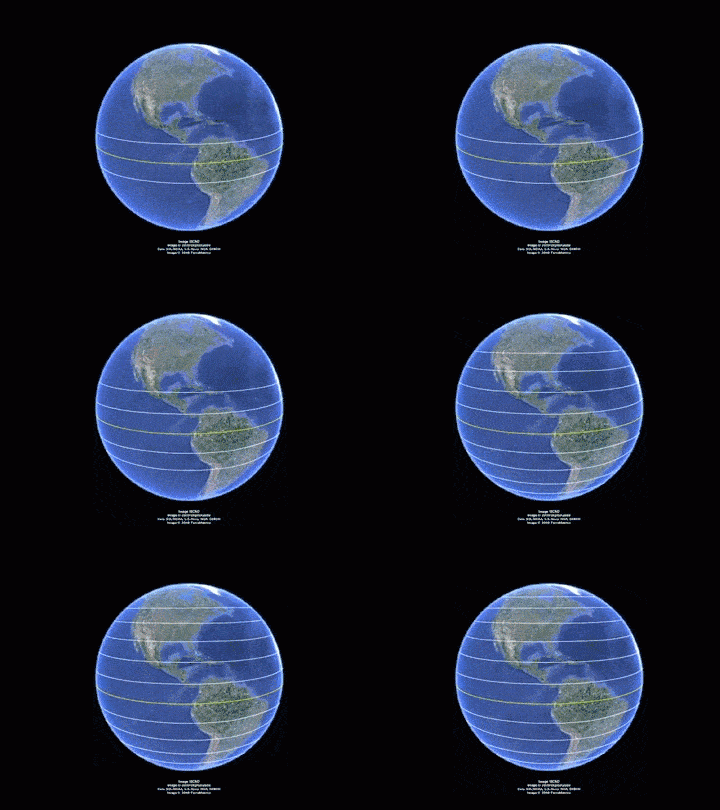
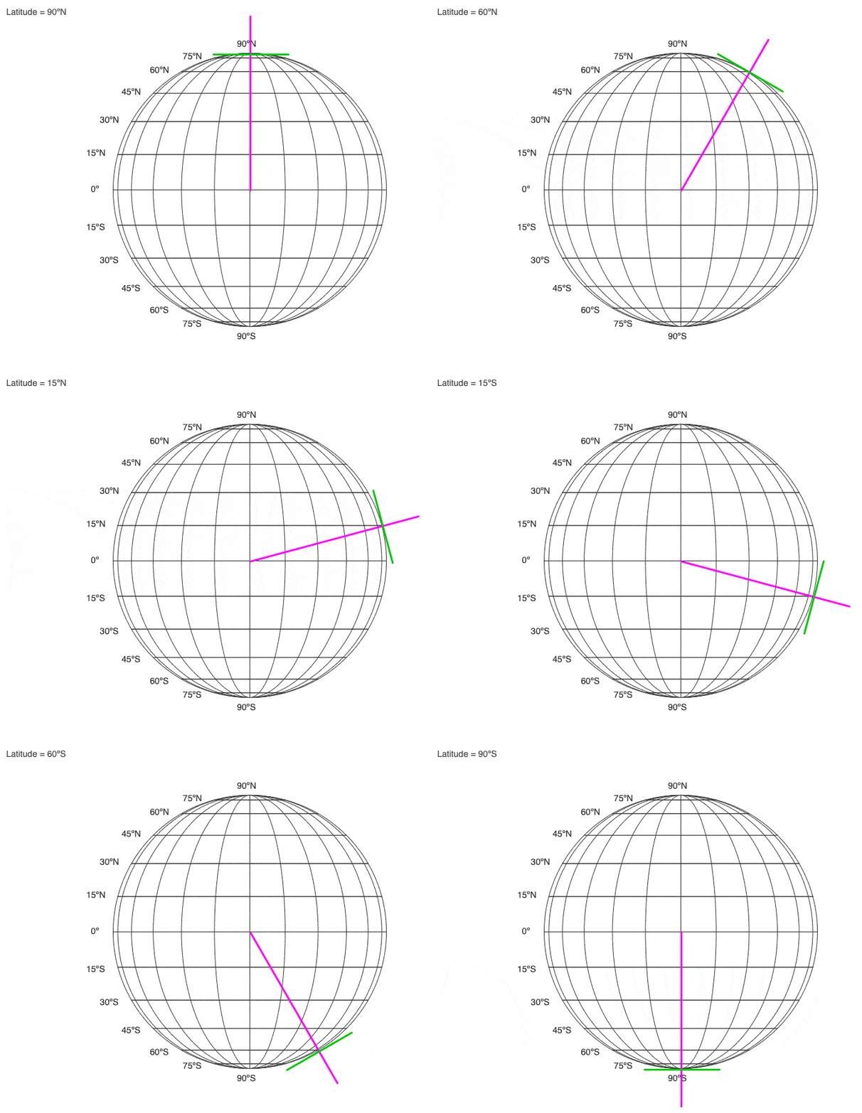
An imaginary circle is drawn between the north and south poles to denote the position of a place on Earth. We call this the equator. This line divides the earth into northern and southern hemispheres. A second line is drawn passing through a place called Greenwich, England, which connects the North and South Poles. The latitude of the equator has been taken as zero degree. The distance between the equator and the North Pole is divided into 90 degree latitudes by parallel lines with a difference of 10-10 degrees. Similarly, the distance between the equator and the South Pole is divided into 90 degrees with a difference of 10-10 degrees. Thus, 90 degrees of North Pole is north latitude and 90 degrees of South Pole is south latitude. The distance between each fraction near the equator is 110.5 km. and 111.9 km near Dhavo. Is. (see picture above)

What are latitude and longitude lines?   "When a ship traveling in the sea is in trouble, it seeks help by radio signals. It is very important for the sea to tell the position of the ship. Longitude is expressed by lines Do you know what latitude and longitude lines are?  An imaginary circle is drawn between the north and south poles to denote the position of a place on Earth. We call this the equator. This line divides the earth into northern and southern hemispheres. A second line is drawn passing through a place called Greenwich, England, which connects the North and South Poles. The latitude of the equator has been taken as zero degree. The distance between the equator and the North Pole is divided into 90 degree latitudes by parallel lines with a difference of 10-10 degrees. Similarly, the distance between the equator and the South Pole is divided into 90 degrees with a difference of 10-10 degrees. Thus, 90 degrees of North Pole is north latitude and 90 degrees of South Pole is south latitude. The distance between each fraction near the equator is 110.5 km. and 111.9 km near Dhavo. Is. (see picture above)     The line connecting the North and South poles passing through Greenwich is assumed to be zero degree longitude. In the east and west of this line, the longitude lines have been drawn up to 180 degrees with a difference of 10-10 degrees. The distance between each part of these lines is 111 km. Is.  With the help of latitude and longitude lines, the position of any place on the earth can be told. For example, 48 degree 50 minutes north latitude and 2 degree 20 minutes east longitude gives the position of Paris. London is located at 51 degrees 30 minutes north latitude and 0 degrees 5 minutes west longitude. These imaginary lines are very useful for sea voyages.


The line connecting the North and South poles passing through Greenwich is assumed to be zero degree longitude. In the east and west of this line, the longitude lines have been drawn up to 180 degrees with a difference of 10-10 degrees. The distance between each part of these lines is 111 km. Is.

With the help of latitude and longitude lines, the position of any place on the earth can be told. For example, 48 degree 50 minutes north latitude and 2 degree 20 minutes east longitude gives the position of Paris. London is located at 51 degrees 30 minutes north latitude and 0 degrees 5 minutes west longitude. These imaginary lines are very useful for sea voyages.

Post a Comment

0Comments
Post a Comment (0)

#buttons=(Accept !) #days=(20)

Our website uses cookies to enhance your experience. Learn More
Accept !
To Top